
REPORT 8
Manton, Near Marlborough, Wiltshire.
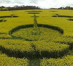
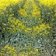
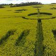
Reported May 4 2009. This Pictogram was discovered from the air in the early morning of May 4 2009. During the night of the creation of the glyph there was moderate rainfall in the local area. The Glyph measures approximately 800 feet in length and around 250 feet at its widest point. The rape-seed crop is around 5 feel high. The formation stretches over the crest of the hill at the top of the field, making any direct full length sight line out of the question - and therefore any attempt at hoaxing this event would be ectremely problematic. More or less all the laid rape-seed plants in the formation were noted as severely damaged at the base of the stems. Also much severe bruising was well evident on the laid plant stems. Some of this damage to the plants can be seen in the ground shots on this page. Most notably this damage shows as dark strips that run down the centers of the narrow avenues in the formation. All damage to this formation looked systematic and intentional, and did not appear consistant with will understood effects seen on 'fake' formations in this type of crop. According to a very qualified and certificated tracker, (KF) who was present during our ibvestigation, "the visible damage to the plants must have occurred between 5 and 6 hours prior to our inspection". This damage therefore must have occurred between 6am and 7am on May 4. A small key-ring torch and a sweet wrapper were found 'placed' in the formation during our late morning inspection of the site, Neither the paper wrapper nor the torch had been exposed to the night-time rain or early dawn dew, therefore it is very probable that they were inserted later in the morning. This could be considered at best extremely curious!. Report by Charles R Mallett © 2009 |
|
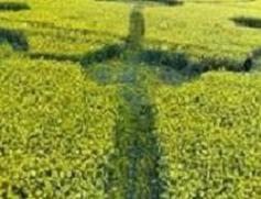


round Shots by Charles R Mallett © 2009
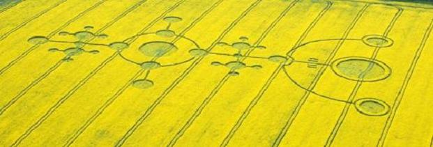
Photo by Annemieke Whatever © 2009
|

All Images And Text © Silent Circle 2010
|